
Satellite Data Sharpens Virginia’s Oyster-Loss Assessment
Virginia officials are combining NASA-supported research, Sentinel-2 imagery and Chesapeake Bay modeling to examine a September algal bloom. The evidence identifies where stressful conditions may have overlapped oyster grounds but does not yet provide a final loss estimate.
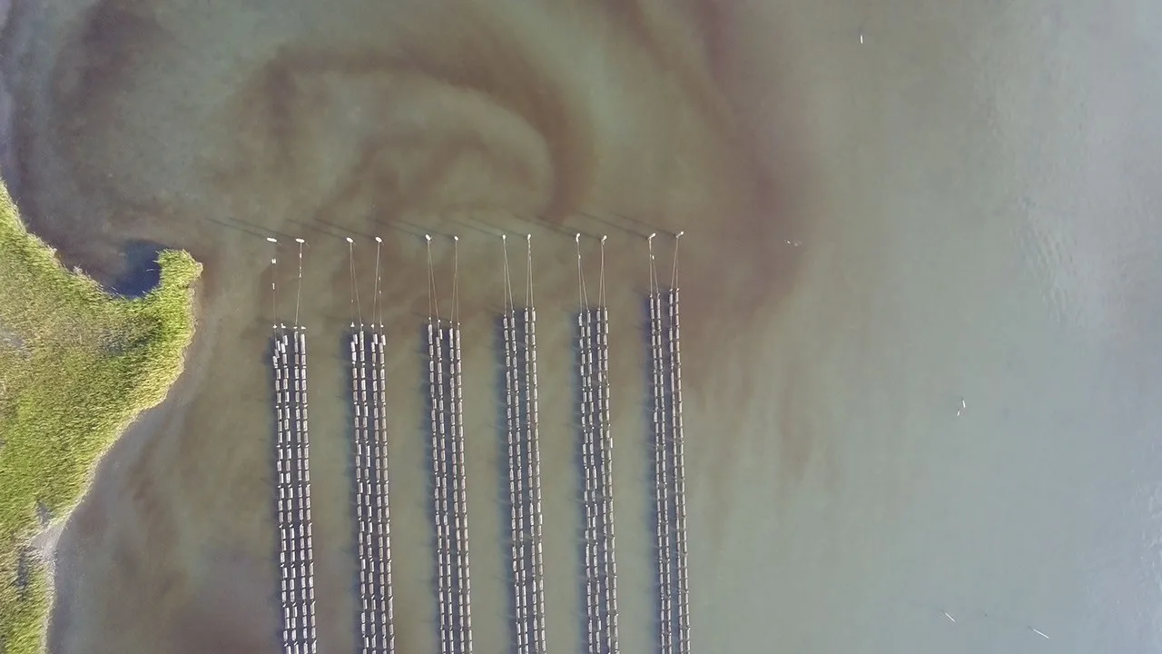
A September harmful algal bloom along Virginia’s Eastern Shore has become a test of how satellite observations, computer modeling and reports from shellfish growers can be combined after a fast-moving coastal event. NASA-funded scientists are assisting state officials as they examine possible effects on commercial oyster farms and restoration areas in the Chesapeake Bay region.
NASA Blogs reported the assessment on Thursday, October 29. The work was still underway at publication, and the information released did not include a final count of oyster deaths, a monetary damage figure or a definitive attribution of every reported loss to the bloom.
Scientists at William & Mary’s Virginia Institute of Marine Science and Batten School documented an almost continuous bloom extending for roughly 15 miles along the Eastern Shore. The observed band ran from Cape Charles to waters south of Nassawadox Creek, placing it near areas where oysters are grown or restored.
Reports of dead fish and oyster losses coincided with the event. Researchers also identified Alexandrium monilatum, an algal species known to harm aquatic life. That combination made the episode a priority for closer analysis, although coincidence in place and time alone cannot resolve how much damage resulted from algae, warm water or other interacting stresses.
At the Virginia Marine Resources Commission’s request, the research team examined imagery from the European Space Agency’s Copernicus Sentinel-2 mission. The imagery was used to map elevated concentrations of microscopic algae, giving regulators a broader view of the bloom than could be obtained from a limited number of sampling locations.
The commission is using those maps and the researchers’ guidance to identify oyster-growing and restoration sites that may have been exposed. This is essentially a process of geographic comparison: analysts can place the apparent bloom footprint alongside the locations of managed grounds and then determine where more detailed investigation is warranted.
Satellite observations are only one part of the evidence. They can reveal patterns across wide stretches of water, but interpretation is still necessary, particularly in complex coastal zones. For that reason, the project also incorporates information from shellfish growers and results from the Chesapeake Bay Environmental Forecast System.
That forecasting system relies on computer models to estimate bay conditions and reconstruct what happened before and during the bloom. Researchers used it to examine water temperature, salinity and winds, three factors that can influence both oyster stress and the location or persistence of an algal concentration.
The reconstruction indicated that water temperatures during much of early September were above the range observed during the same part of the year from 2018 through 2025. Temperatures were near 80 degrees Fahrenheit when the bloom began. The researchers viewed the unusual warmth as a potential source of stress for oysters rather than as a stand-alone explanation for the reported losses.
Wind conditions added another layer. Relatively calm winds may initially have allowed algae to remain in place instead of dispersing. Stronger winds later in the episode may then have driven bloom-affected water shoreward, creating an overlap with oyster-growing areas that might not have been evident from the bloom’s initial position.
The response builds on a project supported by NASA’s Earth Action Water Resources program. Its longer-term purpose is to improve water-quality forecasting by connecting Earth-observing satellites with models and firsthand input from shellfish operators. The September episode offered a practical case in which those separate information streams could be applied to an immediate management question.
For growers, better forecasting could mean more useful warning about where harmful conditions are developing; for coastal managers, it could improve decisions about monitoring and field inspections. Still, the released analysis remained an assessment of potential exposure and contributing conditions. It did not establish the final scale of the oyster loss or announce that the investigation had concluded.