
Coastal erosion shifts vast carbon stores from US marshes to the ocean
A NASA-supported analysis used decades of satellite and elevation data to quantify carbon displaced as marshes eroded from Texas to Maine. The findings highlight a difficult-to-model pathway between land and sea rather than a direct measure of atmospheric emissions.
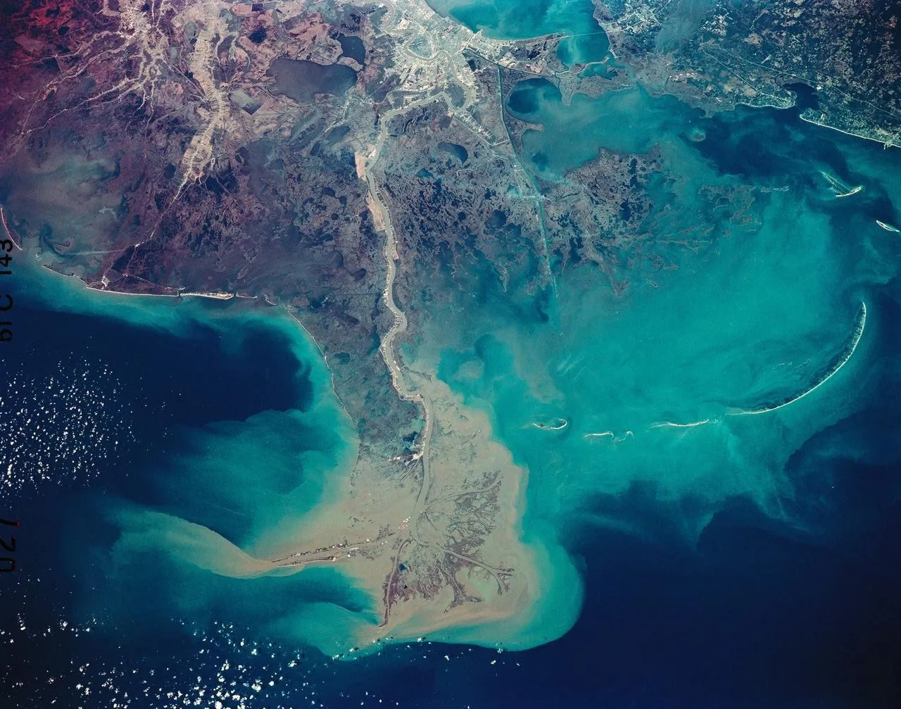
Erosion of coastal wetlands and marshes from Texas to Maine displaces more than 1.45 billion pounds, or 660,000 metric tons, of carbon into the ocean in an average year, according to a NASA-supported study. The estimate was built from observed marsh changes spanning 1985 through 2022.
NASA Blogs reported the findings on Monday, August 24. The research brought together Landsat imagery and US Geological Survey lidar elevation measurements to trace the retreat and expansion of marsh landscapes along the Gulf Coast and Eastern Seaboard.
Marshes are substantial carbon reservoirs because they hold organic material in both vegetation and soil. As in forests and tundra, carbon can remain incorporated in plants and accumulated deposits until the physical environment changes.
On a coastline, that environment is rarely stationary. Rising seas, wind, tides, storms, marine organisms and human development can reshape the boundary between land and water, altering where carbon is stored and how it is transported.
The long Landsat record allowed the researchers to follow changes that would be difficult to capture through isolated field surveys or a single satellite image. Lidar added detailed information about elevation, a critical variable in low-lying wetlands where small differences in terrain affect exposure to flooding and erosion.
The study distinguished gross movement from net loss. Although eroding marshes released large quantities of stored carbon, new marsh growth elsewhere absorbed or retained part of the amount removed from older coastal ground.
After that offset was included, the researchers estimated a net loss of roughly 800 million pounds, or 380,000 metric tons, of carbon each year. The gap between gross and net figures underscores that marsh coastlines can retreat in one place while forming or advancing in another.
Losses were not evenly distributed through either space or time. The Mississippi River Delta showed increases in coastal erosion after Hurricane Katrina in 2005 and Hurricane Ida in 2021, storms that uprooted and submerged miles of vegetation.
Scale made the delta especially consequential. It contains the largest marshland area in the United States and, according to the study, moved more coastal carbon than the entire Eastern Seaboard included in the analysis.
That comparison also illustrates why national totals can be strongly shaped by particular landscapes. A region combining extensive carbon-bearing soils with pronounced physical disturbance can outweigh much longer stretches of coast with smaller marsh areas or lower erosion.
The carbon described in the study was mostly not released straight into the atmosphere. Instead, erosion transferred it from marsh vegetation and soil into the ocean, where the research cited by NASA did not establish a single subsequent fate for all of the material.
This distinction matters when interpreting the headline numbers. Carbon displaced from land is part of the broader carbon cycle, but it is not synonymous with an immediate atmospheric emission; the study focused on transport across the coastline.
Representing that transport in models has traditionally been difficult. Shoreline environments are continuously redrawn by sea-level change, waves, tides, winds and biological activity, making the air-land-ocean boundary far more dynamic than a fixed line on a map.
Researchers at NASA’s Goddard Institute for Space Studies were developing new models to simulate the process more effectively. The observational estimates can provide a clearer basis for describing how much carbon crosses from marsh systems into marine waters.
The 37-year study period also placed major hurricanes within a longer record. That context helped separate abrupt disturbance associated with individual storms from the continuing background of coastal retreat and marsh creation.
The analysis did not reduce marsh change to a claim that all lost carbon had reached the atmosphere, nor did it determine a final destination for every eroded deposit. Its contribution was to quantify a frequently overlooked transfer between two major parts of the Earth system.
By improving estimates at that boundary, scientists can refine the overall accounting of the planet’s carbon cycle. The work portrays coastal marshes not only as stores vulnerable to erosion, but also as active gateways through which terrestrial carbon enters the ocean.