
UN backs fairer world maps after Africa-led campaign
The General Assembly has urged wider use of equal-area maps that show continents in more accurate proportion. The nonbinding measure passed by 164 votes to one, with six abstentions.
UN Member States have overwhelmingly endorsed an Africa-led call to rethink how the world is presented on flat maps. The resolution encourages public institutions, schools, international bodies and technology platforms to use equal-area projections when comparing the size of continents and countries.
The vote was 164 in favour and one against, cast by the United States. Estonia, Georgia, Lithuania, Moldova, Serbia and Ukraine abstained. The measure is advisory: it neither prohibits the Mercator projection nor orders governments to adopt a single alternative.
At the centre of the debate is a familiar world map created by Flemish cartographer Gerardus Mercator in 1569. Its enduring value lies in navigation, because a straight line represents a constant compass bearing. That practical advantage comes with a major visual trade-off: territories appear progressively larger as they move away from the Equator.
The effect can make Greenland look close in size to Africa, even though Africa is about 14 times larger. Northern Europe and North America are also enlarged relative to equatorial regions. African governments argue that generations of exposure to those proportions have done more than distort geography, reinforcing an image of Africa as smaller and less consequential than it is.
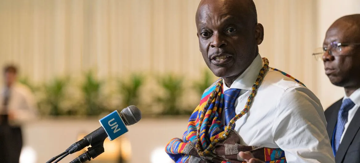
Togo negotiated the text for the African group, building on an African Union-backed campaign. Foreign Minister Robert Dussey told delegates that maps influence education, imagination and collective perceptions. He stressed that the initiative was not an attack on Mercator’s historic contribution or its usefulness at sea, but an effort to match the projection to the purpose for which a map is being used.
The resolution points to Equal Earth, introduced in 2018, and other equal-area designs as better options when relative land size matters. Such projections preserve area but, like every attempt to place a spherical planet on a flat surface, must compromise on features such as shape, distance or direction. The text therefore also promotes teaching about the limitations of all map projections.
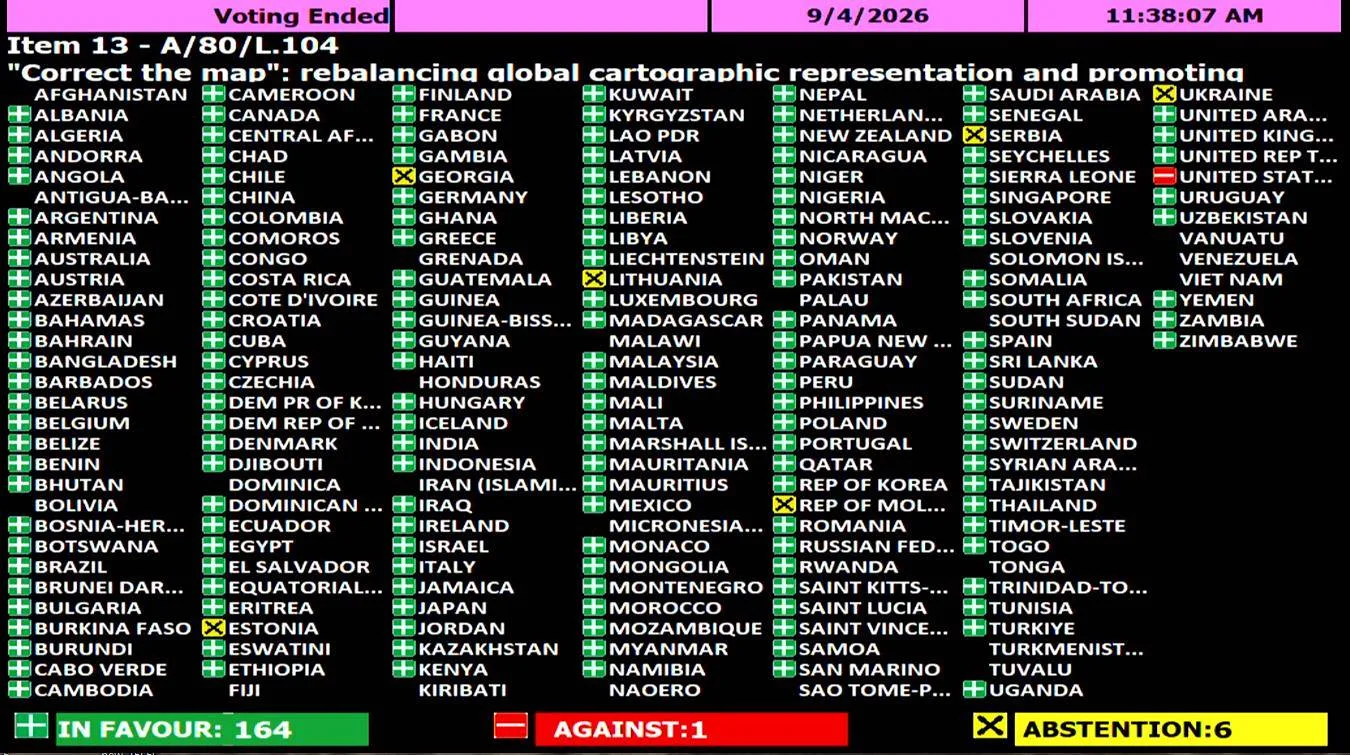
Washington rejected the framing of the initiative. The US representative described it as part of a broader radical ideological agenda and objected in particular to language concerning “cognitive justice” and reparative ideas. France took the opposite course, announcing that it planned to move away from Mercator in official world maps and align itself with the wider campaign.
Ukraine said it supported correcting historical distortions affecting Africa and the Global South but raised concerns about depictions of Ukrainian land under Russian occupation on some maps associated with Equal Earth. Its delegate warned that an endorsement lacking safeguards could create uncertainty around disputed territories.
The European Union supported the resolution while addressing that concern. Speaking for the bloc, Ireland said the decision dealt only with the relative area of landmasses and had no implications for sovereignty, territorial status or internationally recognized borders. The EU also clarified that its vote did not amount to approval of every map published on the Equal Earth website.
Mercator is unlikely to disappear from navigation tools or classrooms as a result of the decision. The significance of the vote is instead political and educational: it gives broad international backing to the argument that cartographic choices are not neutral when they shape how people perceive the scale and place of continents.